Strategic Crime Analysis
The GLA’s Strategic Crime Analysis team utilise a wide range of data held both within the Datastore and their own SafeStats repository to create bespoke analysis tools to aid analysis and decision-making within community safety and emergency service organisations.
Some examples of this work are linked below:
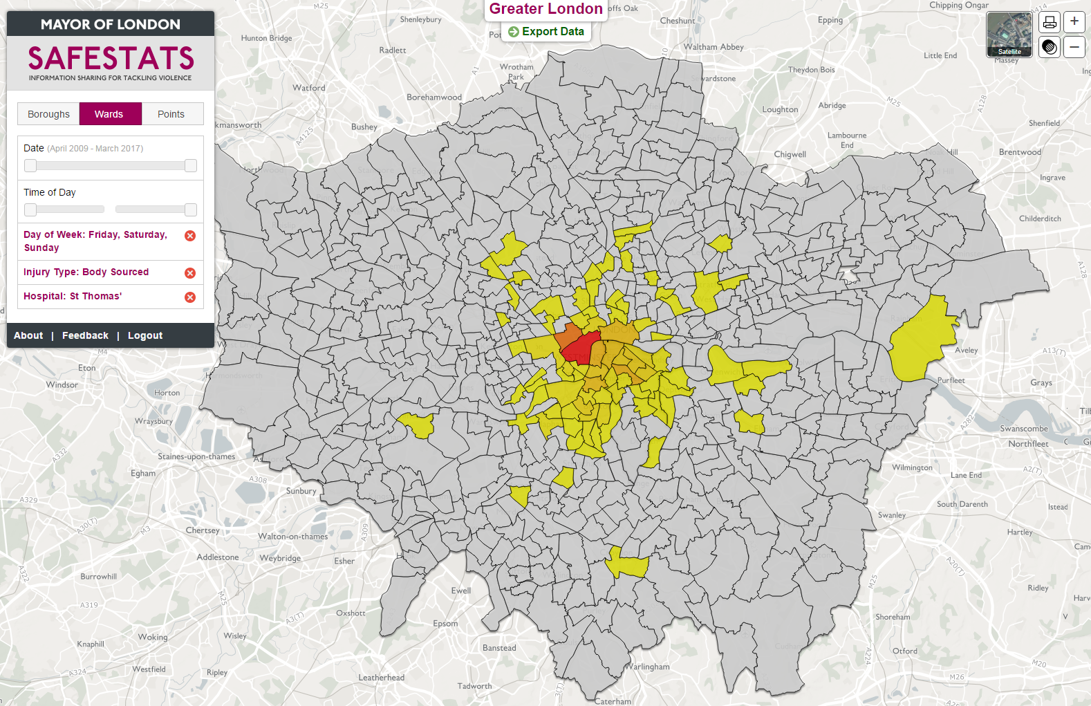
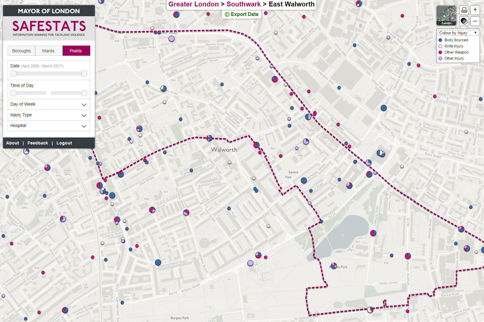
Information Sharing for Tackling Violence – Geocoding
This data forms part of the Home Office Information Sharing for Tackling Violence (ISTV) project, where hospitals are encouraged to record additional information at their A&E receptions around the injuries suffered by victims of violence. This is with the aim of then sharing with other public safety bodies to enrich ongoing preventative work and identify new priorities. The SafeStats data centre was chosen by the Home Office to source, store, process and visualise data from over 25 hospitals in London to enable analysis by colleagues in fields from preventative health, emergency medicine and health analytics.
The team have developed a unique geocoding methodology to turn the wide variety of location information recorded into mapped locations, with built-in confidence levels relating to the quality of the data.
Read more about the project on this Datastore blog, or pages).
The data is available on both SafeStats Data and in a standalone mapping interface – should you wish to have access and work in a relevant field, please contact safestats@london.gov.uk. A user guide for the interface is available here.
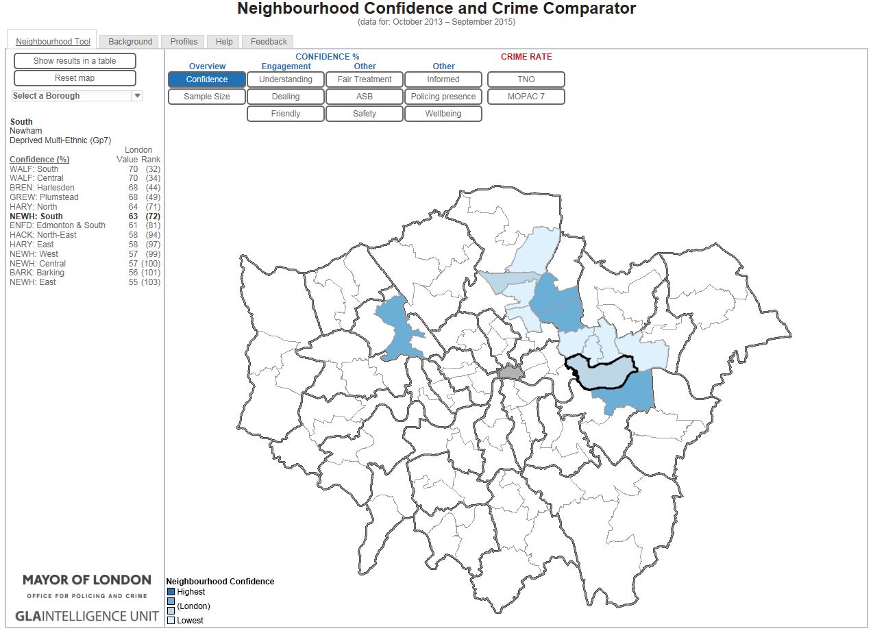
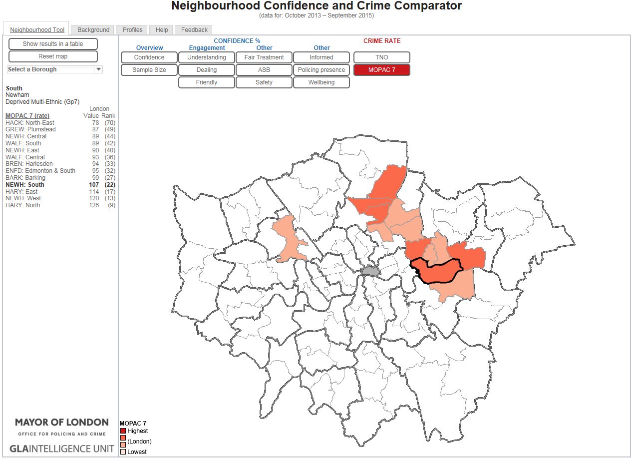
Neighbourhood Confidence and Crime Comparator
The Neighbourhood Confidence and Crime Comparator is an innovative interactive tool that groups London’s policing neighbourhoods into most similar groups, based on profiling data found on the London Datastore, and overlays key public confidence and crime metrics.
By grouping the neighbourhoods, the GLA and Mayors Office for Policing and Crime (MOPAC) have enabled both the police and the public to understand performance compared to similar neighbourhoods in London.
Police and partners now share best practice with like-for-like neighbourhoods. Local communities and public service providers can also benefit from understanding which other areas of London share similar characteristics, even if on the other side of the city.
The Metropolitan Police Service actively utilise the tool at neighbourhood level to identify similar areas where public confidence metrics vary the most, and respond to the challenge of MOPAC to reduce these gaps.
The tool is quick and easy-to-use, hosts the most up to date data available, and provides comparative detail of the underlying issues of trust and confidence in the local communities.
SafeStats
SafeStats is London’s free data hub for crime analysts and community safety professionals. It securely hosts over 15 million pieces of data back to 2001 from police, emergency services and other agencies, bringing that data to life with interactive web-based tools.
For more information see the interactive presentations below or visit www.london.gov.uk/safestats. If you wish to have access, please contact safestats@london.gov.uk.